
Whether one is looking for a mild workout, an activity to do with friends or a great view, hiking provides all of the above. Palo Alto provides a variety of spots for hikers to explore, each offering different strengths to its hikers.
Foothills Park
Open to only Palo Alto residents and their accompanied guests, Foothills Park features a private park close to home. With scenic views and hiking trails for residents of all ages, Foothills Park is a great resource for Palo Altans to explore numerous ecosystems through a variety of hikes.
While the park offers over 15 miles of hiking trails, each of varying lengths, sceneries and difficulties, the longest hiking trail is known as the Los Trancos Trail. Weaved along the Los Trancos Creek, this 7.5-mile long hiking trail transitions between open space views of Portola Valley, woodland forests beside the meandering creek and occasional seasonal waterfalls along the trail. The Los Trancos Trail, while lengthier than other local hikes, is fairly flat and gradually rises 985 feet throughout the hike. If one is looking for a more strenuous hike at this site, the Steep Hollow Trail rises 425 feet in only 0.6 miles and is surrounded by a towering oak woodlands ecosystem. On the other hand, if one is seeking an easier hike, the Sunrise Trail, Coyote Trail, Panorama Trail, Toyon Trail and Chamise Trail are all viable options, with less than two miles of trail and fairly flat terrain.
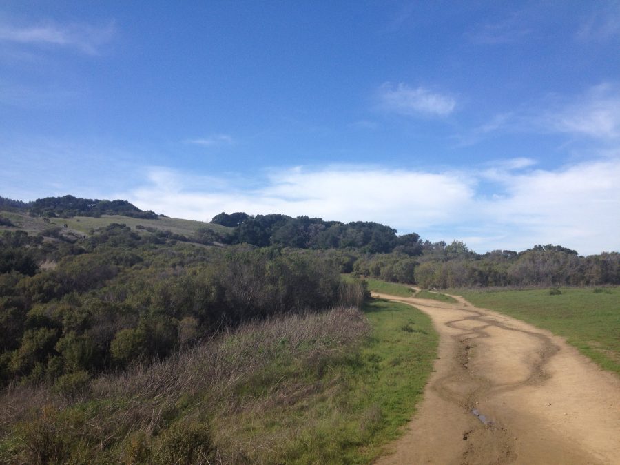
The Dish
“The Dish” is the name of a radio telescope used for space communication located in Stanford University. However, the term is more commonly used to refer to the paths that weave throughout the Stanford foothills. The 3.5-mile recreational trail was recently repaved during the summer of 2015, providing a smooth but very hard black pavement for visitors to run and walk on, though bikes and animals are not allowed. One can reach a maximum elevation of 500 feet above sea level.
The Dish is split into two parts, the “Lower Dish” and “Upper Dish,” with two long, steep hills connecting the two parts on either side. The entire dish itself is riddled with plenty of short and long steep hills, providing a strenuous workout for both joggers and walkers.
However, visitors only have one chance to get a sip of water from the Dish’s single water fountain, nestled at the end of one of the Dish’s many hills. Water is a must when traversing the Dish, as the black pavement combined with the powerful sun makes for a scorching workout. Once visitors reach the Upper Dish, however, the view of Stanford and Palo Alto makes the heat and steep hills worth it.
Mission Peak
Nestled in Fremont, Calif. next to Ohlone College, Mission Peak is known for its breathtaking view at approximately 2,517 feet and its trademark Mission Peak Monument, where many people climb the signature Monument pole at the end of the upward climb. The rigorous 5.6-mile hike consists mostly of grassland and rolling hill views, but one might also encounter scraggly trees, natural wildlife and rocky terrain along the way.
As one ventures through the trail, unique views of the South Bay are sprinkled throughout the hike. The beginning of the hike is not too strenuous, and consists of mostly flat land that weaves through grassy hills. On the other hand, the end of the hike consists of far steeper slopes paired with rocky terrain, making the final strides to the top much more rewarding.
Windy Hill Open Space Preserve
At the heart of the beautiful Portola Valley, Windy Hill Open Space Preserve offers two peaks — the Sausal Pond and a diverse array of hiking experiences. The Windy Hill Open Space Preserve is characterized by its breezy grassland ridges and redwood, fir and oak forests.
The Spring Ridge Trail, a total of about 2.7 miles from the Portola Road parking lot and the Windy Hill peak, provides an open trail and 360 degree views as one climbs the hills towards the peak. Although the one-way trip is fairly short, the spring ridge trail is filled with steep hills, making for an enduring hike up to the peak. However, once one reaches the Windy Hill Peak or the Herb Grench Overlook, one will be greeted with spectacular views of the surrounding area, including Palo Alto landmarks like Hoover Tower and the Dish in the distance.
The Hamm Gulch Trail, on the other hand, is a 2.6-mile trail along the middle of the land, and is embedded in the distinctive redwood, fir, and oak forests that constitute the preserve. This trail, along with the 2.3-mile long Razorback Ridge Trail, contain plentiful switchbacks, making the hike much more interesting as one ventures through the winding wonders of the forest. The Eagle Trail, which connects the Hamms Gulch and Razorback Ridge Trails in 0.7 miles, is an especially distinctive hike, seeing as it is not exactly a trail, so much as it is simply the road along the side of Alpine Road.
The Windy Hill Open Space Preserve ensurses that hikers know where they are going by placing helpful signs at every turn or fork in the road. As long as one pays attention to the signs along the trail, one should have no problem navigating the hike. In general, this site is a great resource for students to explore scenic views on the peaks of Windy Hill and Herb Grench Outlook, meander through the switchbacks of Hamms Gulch and Razorback Ridge or venture an alternative hiking experience along the roads of Eagle Trail.